Around 5 a.m. on a gray Tuesday, the kind of morning when the streetlights feel too bright for the sky, meteorologist Laura Benson watched a jagged swirl of purple on her screen slide south. The coffee on her desk had gone cold. Her phone was already buzzing with messages from colleagues in Europe and North America: “Are you seeing this too?”
On the map, the Arctic air looked like a living thing, breaking away from its usual icy crown and spilling down toward cities that still had Christmas lights tangled in balconies.
Outside her office window, the parking lot looked calm. Inside, every new model run was a little more alarming than the last.
Early February had just acquired a new kind of tension.
Atmospheric alarms are flashing long before the cold arrives
The first hint that something was off came from high above our heads, far beyond the clouds we watch from our kitchen windows. Meteorologists started noticing strange ripples in the stratosphere, around 30 kilometers up, where the polar vortex usually spins like a disciplined top over the Arctic.
This year, that top has started wobbling.
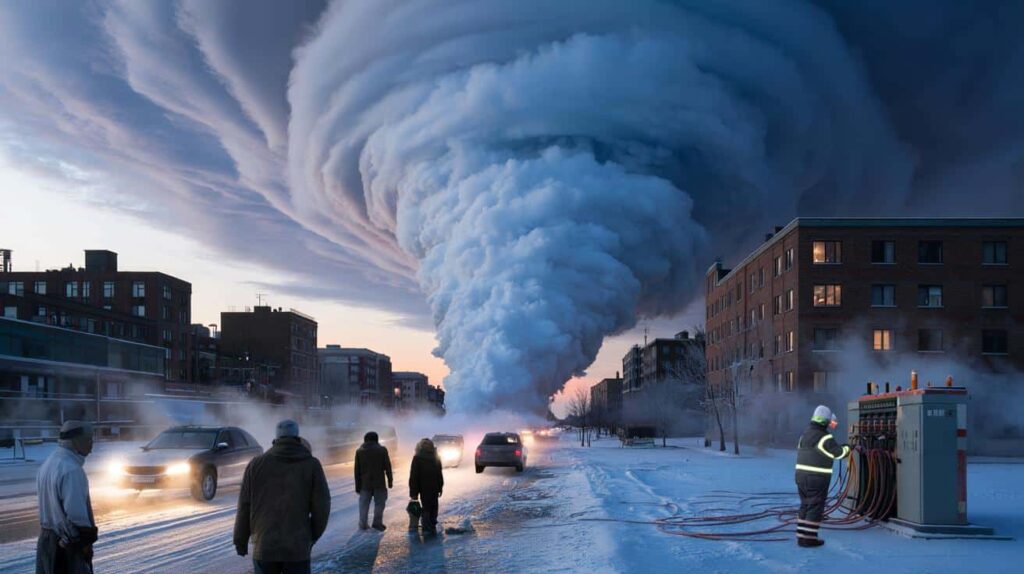
Instead of staying trapped over the pole, pockets of icy air are slipping out of their cage, drifting toward populated latitudes that thought they were easing into a mild late winter. It doesn’t look like much when you step outside to grab the mail. On the maps, it looks like the prelude to a dangerous Arctic anomaly.
One European weather center quietly updated its seasonal outlook last week. A graphic that had shown soft yellows and oranges — symbols of milder-than-normal conditions — began to bleed blue over large parts of North America, Europe, and parts of Asia.
In the same 24 hours, an Alaskan monitoring station logged a sudden spike in upper-atmosphere wind disruption, a classic early sign that the polar vortex is about to split or sag. On social media, amateur weather watchers started posting screenshots of temperature plunges that didn’t match the local forecasts people had in their apps.
Behind each of those screenshots is a potential story: frozen pipes in homes that barely have insulation, overloaded grids, farmers staring at vulnerable winter crops, commuters stuck on dark highways in flash-freeze conditions. The maps are abstract; the risks are not.
What’s brewing over the Arctic has a name: a stratospheric disruption event, the kind of thing that can unlock deep cold and send it spilling south for weeks. The basic idea is simple. The polar vortex weakens, wobbles, or splits, and the atmosphere tries to rebalance by rushing cold air toward lower latitudes.
The complication comes from the background state of the planet. A warmer world holds more moisture, fuels sharper contrasts, and can sometimes flip the script on what “normal winter” even means.
So instead of a smooth, predictable season, we get sharp mood swings — warm spells that melt the snow followed by brutal, flash-freeze Arctic blasts that roads, buildings, and people are rarely prepared for. That’s the danger lurking behind those polite-sounding “signals aloft.”
Reading the signals — and what people can actually do with them
For forecasters, the next two weeks are like watching a slow-motion car approaching black ice. They zoom in on temperature anomalies at various heights, trace wind patterns circling the pole, and compare dozens of model runs that each nudge the cold air a little differently.
One practical method stands out: tracking “Arctic loading,” a sort of pressure buildup that shows where the cold air is being stored, and where it’s most likely to burst out. When that loading shifts from the central Arctic toward, say, Siberia or northern Canada, alerts start flying.
At that point, the quiet phrase *“enhanced risk of high-impact cold events”* usually appears in internal bulletins long before TV anchors start talking about “polar plunges.”
This is where regular people often get caught off guard. Forecast apps show a simple seven-day line, maybe a ten-day extension if you swipe. The atmospheric signals meteorologists are looking at stretch beyond that, hinting at patterns that don’t fit neatly into an hourly forecast.
So you get a weird mix in daily life. One day you’re walking the dog in a light jacket, wondering if winter is basically over. Two weeks later, you’re searching the basement for that old space heater and a half-ripped blanket because an Arctic outbreak showed up ahead of schedule. We’ve all been there, that moment when you realize you should’ve listened a bit closer to that “long-range outlook” your local weather person tried to explain in 90 rushed seconds.
Plain truth? **Most of us only pay attention to weather when it ruins plans.**
That gap between what meteorologists see and what we act on is what worries people like Laura Benson. She told me that early February this year has “the fingerprints of something we’ve seen before, but with more energy in the system.”
“The signals are not subtle,” she said. “We’re seeing a disturbed polar vortex, strong wave activity, and consistent model agreement. That combination, for me, says: this is not just another cold snap. This has the potential to reshape how late winter feels for millions of people, especially those who think the worst is already behind them.”
- Watch updates from trusted national meteorological services, not only viral maps on social media.
- Look for language like “Arctic outbreak,” “polar vortex disruption,” or “sudden stratospheric warming.”
- Use any mild days ahead of the cold to check pipes, seals, and backup heating options.
- Talk to elderly neighbors or relatives now, while conditions are still manageable.
- Plan for energy spikes: layered clothing, draft stoppers, and low-tech ways to stay warm matter.
A strange winter crossroads that says a lot about our future
The creeping tension around this early February Arctic anomaly isn’t just about the next cold spell. It’s about what kind of winter world we’re sliding into, one shaky season at a time. On the one hand, long-term data shows winters getting milder overall, with shrinking sea ice and less persistent snow cover. On the other, these wild, jagged extremes keep punching through, shattering local records for both heat and cold, sometimes in the same month.
There’s a strange dissonance in watching cherry trees budding early while knowing a brutal freeze may be lining up just offstage. Farmers call it a nightmare scenario. Parents call it “sending kids to school in three different outfits in one week.” Cities call it “budget chaos,” with snowplows on standby while roads crack from thermal whiplash.
What’s building now over the Arctic is a kind of test. Not just of forecasting skill, but of how seriously we take early warnings when the sky outside still looks boring. Some readers will shrug and scroll past, trusting they’ll adapt, as people always have. Others will share maps with friends or group chats, not from panic but from a quiet sense that this winter, and the ones coming after it, are asking us to pay closer attention than we’re used to.
| Key point | Detail | Value for the reader |
|---|---|---|
| Arctic anomaly signals | Disturbed polar vortex and stratospheric disruptions detected in early February | Helps anticipate when “routine winter” could flip into a dangerous cold pattern |
| Practical lead time | Signals often appear 10–20 days before surface impacts are felt | Gives a crucial window to prepare homes, travel, and support vulnerable people |
| Everyday adaptation | Layered planning: follow alerts, secure heating, protect pipes and neighbors | Turns abstract climate and weather data into concrete, protective actions |
FAQ:
- Question 1What exactly is an “Arctic anomaly” in this context?It refers to a significant, unusual disruption in the normal behavior of Arctic air masses and the polar vortex, leading to abnormal cold spreading into regions that typically don’t see such intensity or timing of freezing events.
- Question 2Does a disturbed polar vortex always mean extreme cold where I live?No. The cold has to be steered in your direction by jet stream patterns. Some areas can end up mild while others get hammered. That’s why regional forecasts and updates from local services matter so much.
- Question 3How far ahead can meteorologists really see these events coming?Upper-atmosphere signals can show up 10–20 days ahead, sometimes a bit more, but the exact timing and location of the cold only sharpen within about a week. The broad risk window is real; the fine detail comes later.
- Question 4Is this anomaly caused by climate change?Scientists are still working out the precise links, but they’re seeing growing evidence that a warming Arctic can destabilize the polar vortex more often. That doesn’t cancel winter; it can twist it into sharper, stranger shapes.
- Question 5What’s the simplest thing I can do right now?Take five minutes to glance at trusted national or regional outlooks for the next 2–3 weeks, then do one small, practical thing — check a drafty window, locate emergency blankets, or talk with a neighbor who might struggle if a deep freeze hits unexpectedly.